
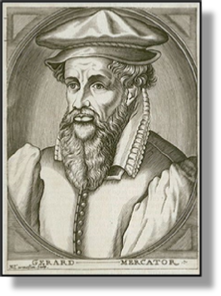
xxxxxThe German mapmaker Gerardus Mercator produced a number of maps -
GERARDUS MERCATOR 1512 -
Acknowledgements
Mercator: by the French engraver Nicolas III de Larmessin (1684-
 xxxxxGerardus Mercator (the Latinised form of his name Gerhard Kremer), was born in Flanders of a German family. He first studied the humanities and philosophy at the University of Louvain, but after two years of further study at Antwerp and Mechelen, he acquired an interest in geography. Returningxto Louvain he teamed up with the eminent physician and astronomer, Gemma Frisius (1508-
xxxxxOver the years 1535 to 1537 they constructed their first terrestrial and celestial globes and, in the same period, Mercator -
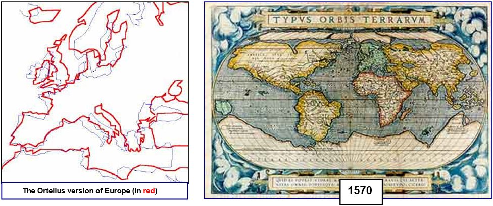
xxxxxThe latter part of his life was spent at Duisburg, where he became the court cosmographer to Duke Wilhelm of Cleves. It was during this period that he perfected and then published in 1569 a world map using the method of projection which today bears his name. Only four of these maps are still in existence. In this method, the parallels and meridians are drawn uniformly at right angles over the entire map, forming a grid. This method clearly distorts the land-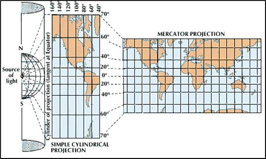 used for navigational purposes because courses could be plotted along straight lines without the need for constant compass readings. During this period he also produced another collection of maps, including ones of Europe and the British Isles, and a very accurate map of Lorraine based on a detailed survey -
xxxxxHis final and most ambitious project was the compilation of a great "Atlas", designed to contain a large collection of maps. The first section, begun in 1569, was a chronology of the world from its creation to the year 1568. To this he added 27 maps originally prepared by the Greek geographer Ptolemy, and then another section with revised maps of the Netherlands, France, Germany, Greece and the Balkans. Before his death in 1594 he finished the section of maps on the British Isles, and the entire work -
xxxxxIncidentally, it was Mercator who coined the word "Atlas" to mean a collection of maps. On the cover of his last big project he put a picture of Atlas, the Titan, carrying the world on his shoulders.
 xxxxxThe first modern atlas is considered to be the one produced by the map-
Including:
Abraham
Ortelius

L1-
xxxxxAs we shall see, further advances in map making were made by two Frenchmen during the 18th century: Guillaume Delisle (1700 W3) and Bourguignon d'Anville (1743 G2).
xxxxxIncidentally, as noted earlier, Ortelius was a friend of Pieter Bruegel the Elder and much admired his work. In his Album of Friends, completed in 1573, he describes the Flemish painter as “the most perfect painter” of his time.