
Acknowledgements
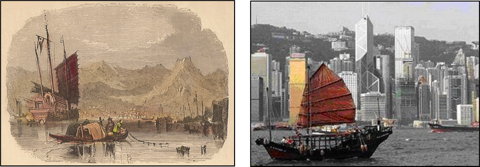
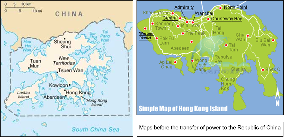
Map (Hong Kong): considered to be in the public domain- https://en.wikipedia.org/wiki/Outline_of_Hong_Kong. Map (Hong Kong Island): from www.chinesetouristmaps.com/Hong Kong Island Maps. Harbour Views: dates and artists unknown.
Vc-1881-1901-Vc-1881-1901-Vc-1881-1901-Vc-1881-1901-Vc-1881-1901-Vc-1881-1901-Vc
xxxxxAs we have seen, the Island of Hong Kong - together with a number of neighbouring islands - was acquired by the British by the Treaty of Nanking, held in 1842 (Va) at the end of the First Opium War. It quickly became a thriving commercial port and centre within the British Empire. The Kowloon Peninsula on the Chinese mainland was added to the territory by the Peking Convention of 1860 after the Second Opium War - beginning in 1856 (Va) - and this area was further extended in 1898 by the addition of the New Territories, acquired on a 99 year lease.
xxxxxThe colony was invaded and occupied by the Japanese from 1941 to 1945 (during the Second World War), and in 1984 an agreement was reached between Britain and China whereby the full sovereignty of the islands, the Kowloon Peninsula and the New Territories would be passed to China at the expiry of the lease in 1997. The British withdrew in that year, but the Chinese agreed that the territory would be governed as “a special administrative region” wherein it retained its own currency and taxation system, and maintained its free port status.